The first week of September has brought us spectacular late summer weather, and more is on the way for next week.
However, a few days of chilly and wet weather will be sandwiched between the two stretches of warm and dry weather. Unfortunately, the timing for the autumnal weather lines up with the weekend, much like we have seen a lot of this summer.
RELATED: No region in Canada spared from this summer’s weather afflictions
In other words, the first full weekend of September will feel more like October.
This weekend will also bring us periods of rain, but it won’t be a total washout.
Weekend washout replaces the stretch of late summer sun
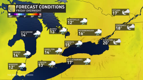
Our current stretch of gorgeous weather will come to an end on Friday as increasing clouds will spread across southern Ontario. Showers and scattered thunderstorms will develop from west to east across the region, especially north and west of Toronto. Temperatures will still be warm, especially south and east of Toronto where there will be more sunshine.

Friday evening and Friday night will be a washout across most of southern Ontario, including the Greater Toronto Area (GTA) as a widespread soaking rain, with thunder possible, tracks from west to east across the region. However eastern Ontario should remain dry until Saturday.

Saturday will be noticeably cooler with showers likely, especially during the morning.
DON’T MISS: Ontario on waterspout watch this weekend
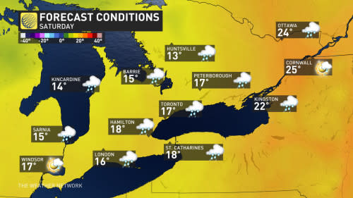

Some sunny breaks are expected to develop during the afternoon and early evening, primarily for areas south of a line from near Sarnia to Lake Simcoe, and east to the Belleville area.
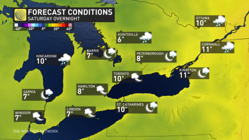
Saturday night will be partly cloudy and chilly. Showers will continue across cottage country and eastern Ontario.

Early October-like temperatures end the weekend
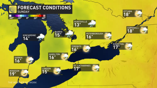
Sunday will be an autumnal day with changeable conditions. Most of southern Ontario will see some sunshine, but passing showers are also likely. The showers will be more continuous and widespread for areas to the east of Lake Huron and Georgian Bay, and across cottage country.
Temperatures more typical of early October with a brisk wind.

The threat for showers will linger into the beginning of next week and temperatures will continue to be on the cool side of seasonal.
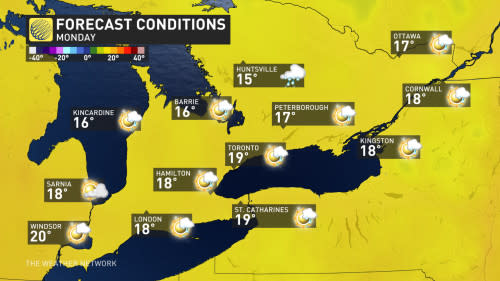

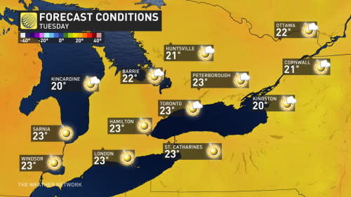
However, abundant sunshine will return for most of next week, and temperatures will rebound back to near seasonal and possibly a couple degrees above seasonal by Tuesday.

Don’t write summer off just yet
Pleasant late summer weather is expected to continue through the end of next week.
September Outlook: Summer isn’t done with Canada just yet
Will the following weekend bring another poorly timed interruption to the warm and dry weather?
At this point we are cautiously optimistic that next weekend will be much warmer and drier than our upcoming weekend, but please check back next week for an update.

