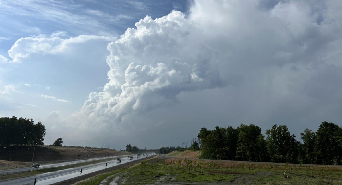
The autumnal equinox is only days away, but the weather across northwestern Ontario is still behaving in ways that are more reminiscent of mid-summer than late-summer.
Temperatures across the region have stayed above-seasonal thanks to a ridge of high pressure over the United States’ Midwest.
A similar pattern is setting up this week, which will prolong the late-season heat and set up the ingredients for stormy, severe weather on Sunday and Monday.
Visit our Complete Guide to Fall 2024 for an in depth look at the Fall Forecast, tips to plan for it and much more!
Loud rumbles of thunder passed over Kenora and its surrounding communities early on Sunday morning as a weak low-pressure system pushed into the region.
While a severe thunderstorm warning was issued for Kenora, the biggest threat for severe weather will be in the afternoon and evening on Sunday.
Warm front brings potential for severe weather later Sunday
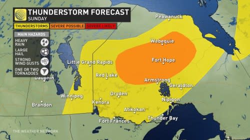
A warm front from a low-pressure system sweeping over the Prairies will collide with a stationary front over northwestern Ontario’s northern region on Sunday afternoon, triggering storm development that will last into the evening.

Due to the added heat, and therefore energy, available for these storms to tap into, it’s likely we will see some severe storms develop, especially in the areas north of Lake Nipigon.
The main hazards we are looking at for these severe storms will be heavy rainfall, large hail, as well as strong and gusty winds.
There is also a small risk of these storms having embedded rotation, which raises the risk of one or two tornadoes developing. While this is a small possibility, it is still non-zero, so make sure to keep an eye on your local alerts.

Severe weather risk will renew Monday evening
A Montana low will be pushing northward into the southern Prairies on Monday, setting up a stormy pattern across the three provinces this week and bringing above-normal temperatures to the eastern Prairies and northwestern Ontario.
SEE ALSO: 2024 confirmed as costliest year on record for weather disasters in Canada
As the low pushes northward, its associated warm front will sweep into southern Manitoba, possibly triggering a round of severe weather on Monday evening. This severe weather may also spill over into northwestern Ontario, including Kenora and Fort Frances.
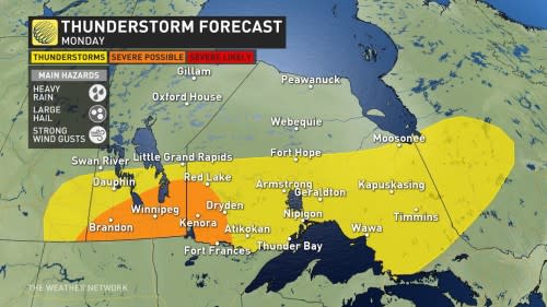

It’s possible the storms could organize into a mesoscale convective system (MCS), which is a cluster of strong storms that can sustain themselves independently of any large-scale weather system.
Along with the risk for heavy rainfall, storms within an MCS are well known for their damaging winds.
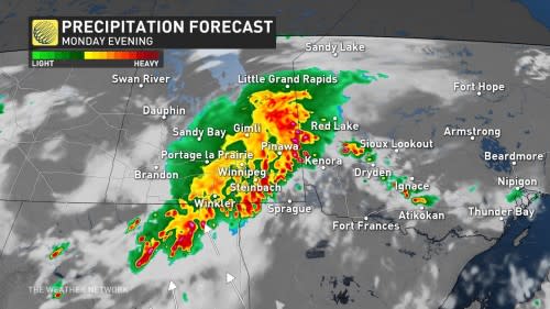

In addition to being known for producing damaging winds, MCSs are also known for their long-living nature. So while the storms may be developing in southern Manitoba, around Winnipeg, it’s quite possible for them to reach northwestern Ontario without losing any steam.
Forecasters will be keeping a close eye on conditions and refine the forecast further as time progresses.
Stay with The Weather Network for more forecast updates and information on your weather across northwestern Ontario.
Thumbnail image taken by Mark Robinson near Kitchener-Waterloo, Ont., on June 20, 2024.

